Reconnecting the City
To create a pedestrian friendly path through the city of Sarajevo, stretching from the river walkway to the main train station. We approached the problem by first analyzing the site conditions. This area of the city has all of the resources that it needs to be a thriving city center except the lack of connection between programs. The site is split into thirds by two major roadways that have no clear or easy way to cross. The zones are the river walk area behind the national history museum, an abandoned lot next to the university campus, and train station. The issues that were being dealt with overall was the lack of pedestrian connection but each zone has it’s own peculiar issues as well. The river walk is an important connection across the river as there is a bridge that links the two sides at this point. There is nothing at this site though to announce it’s importance or to mark a meeting place for people crossing. Also this area is known to for having community concerts and gatherings. The next zone is the abandoned lot next to the campus. The problems here are that the lot itself lies along an all but deserted road that butts up against the U.S. Embassy wall. This creates a very unwelcoming place to walk through. The last zone is the train station; here there is an immense concrete plaza that gets used for media events. The plaza is extremely imposing and when standing inside it makes you feel very small. Also the street tram has a major stop here but there is nothing that shows you where to wait. The overarching solutions that we came up with were to create pedestrian friendly pathways throughout the city, welcoming public spaces, and programmed community space. Simply implementing a series of crosswalks and streetlights to make crossing the street easier and safe solved the issue of crossing the main roads. Also a series of colorful canvas canopies were placed covering the new designed pathway. These canopies serve to announce the path so you know where to go and also provide areas of shade and sunlight. The solutions along the river walk are to design a bandstand for the concerts that already take place, build a café with seating that marks the bridge crossing the river and to act as a meeting place for people crossing, and turn the unused space into a park. The abandoned lot area gets redeveloped into a new campus quad for the university. This serves to bring the walk along the street into a more populated space within the campus. Here I implemented a few new buildings that house university functions but also are used to hide the imposing embassy wall. At the train the large open plaza has been redesigned into three smaller zones. The eastern and western zones act more as pedestrian walkways lined with trees, small reflecting pools, and “information screens”. The middle zone remains as an open space that can be used for the media events, although the area has been sunken down two steps to allow for seating. The tram stop becomes more expressed by using the canvas coverings to designate the waiting area. |
||
Existing Conditions: 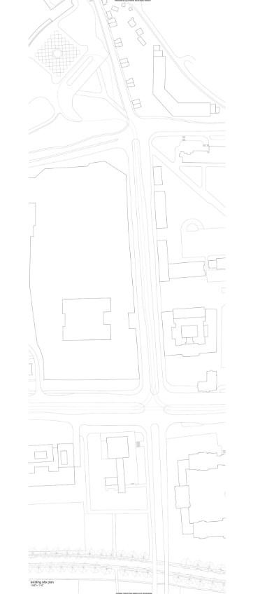 Site Plan: 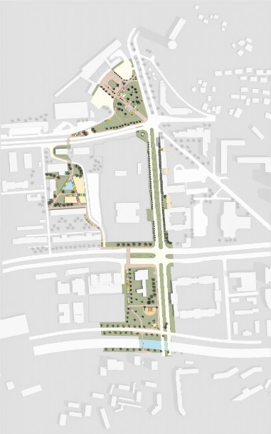 Diagram Highlighting Open Space: 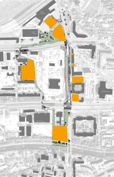 Diagram Highlighting Educational Facilities: 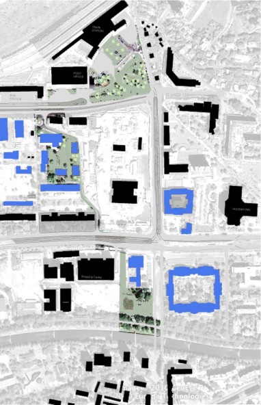 Diagram Highlighting Residential Facilities: 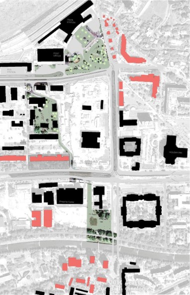 Diagram Highlighting Transit Facilities: Aerial View 1: 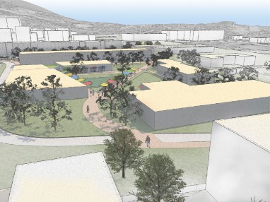 Aerial View 3: 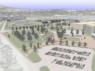 Train Station View 2: 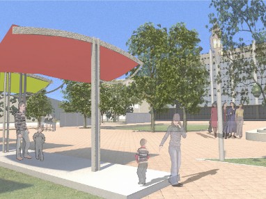 Train Station View 4: 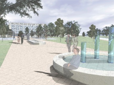 Campus View 1:  Campus View 3: 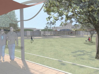 Street View 1: 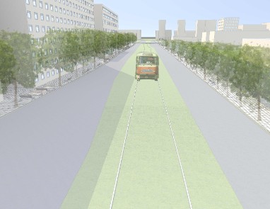 River Walk View: Model Picture 1: 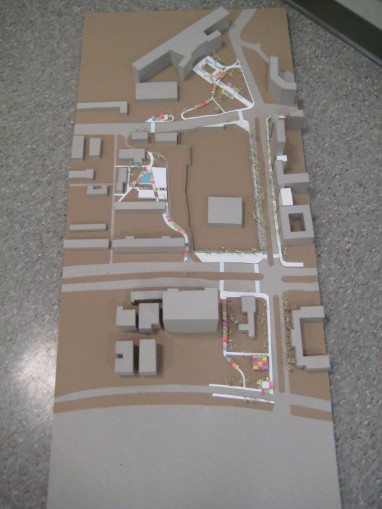 Model Picture 3: 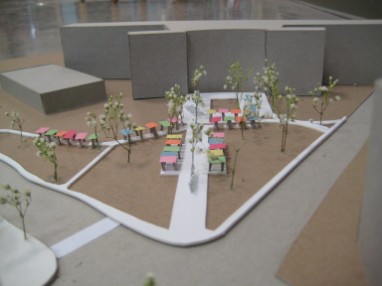 |
Proposed Interventions: 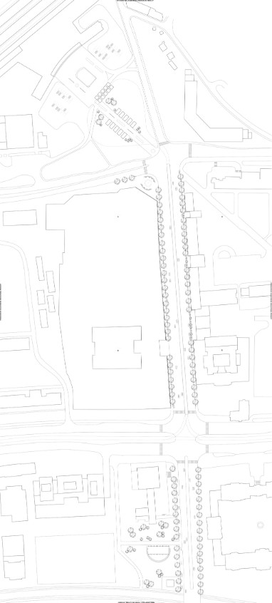
Diagram Highlighting Pedestrian Paths: 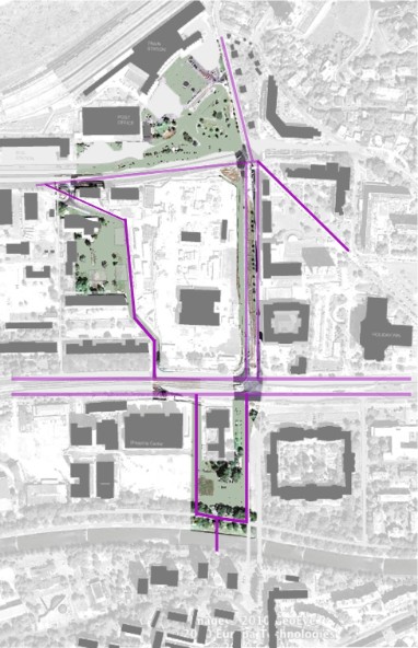 Diagram Highlighting Government Facilities: 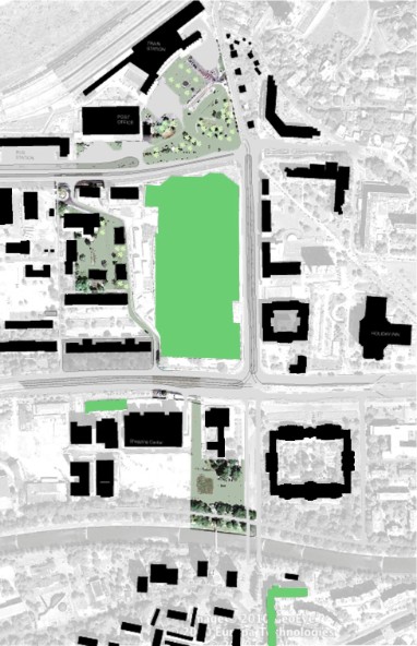 Diagram Highlighting Retail Facilities: 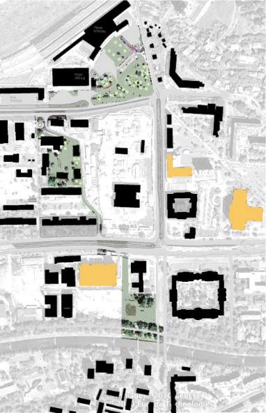 Diagram Highlighting Area: 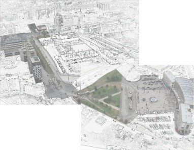 Aerial View 2: 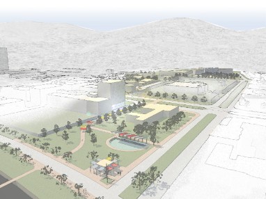 Train Station View 1:  Train Station View 3:  Bus Station: 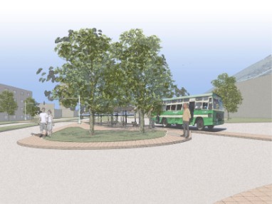 Campus View 2: 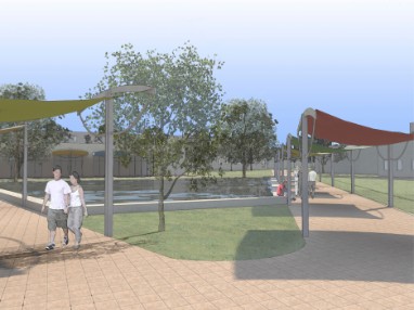 Amphitheater: 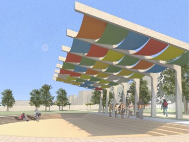 Street View 2: 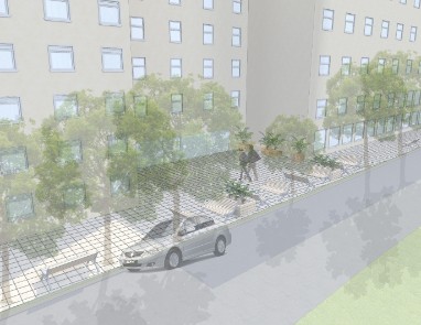
Model Picture 2: 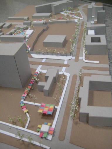 |
|